Highlights:
- Monger Gold has received exceptional assay results from its maiden soil sampling program at the Scotty Lithium project.
- The company has delineated five targets based on the 3D modelling and soil sampling results.
- On the company’s claims, peak lithium concentration is more than double the peak value encountered in the adjoining Bonnie Claire Lithium Deposit.
- Monger Gold plans magnetotelluric (MT) surveys within each zone to define the basin extent and optimise subsequent drilling programs.
ASX-listed resource exploration company Monger Gold Limited (ASX:MMG) has received exceptional assay results from a soil sampling program on its 78.1km2 Scotty Lithium Project in Nevada, US.
The assay results and the 3D modelling of the enclosed basin have helped delineate five target areas, each capable of holding standalone exploration potential.
The assay results have exceeded the company's expectations, producing a peak value of 540ppm lithium, more than twice the peak value of 264ppm lithium for the adjoining Bonnie Claire Lithium Deposit.
The Bonnie Claire Lithium Deposit has an inferred resource of 3.4Bt @ 1,013ppm Li for 18.3Mt of Lithium Carbonate Equivalent (LCE).
Soil assays deliver five target areas at Scotty lithium project
The assays from 643 systematic single-hole auger samples produced favourable results, as seen from the comparative analysis of above values. ALS Laboratory in Nevada undertook the analysis.
Out of the 643 soil samples taken, approximately 14% or 89 samples recorded values higher than Bonnie Claire's peak value of 264ppm lithium. At the same time, around 27% or 177 samples documented values greater than 200ppm lithium.
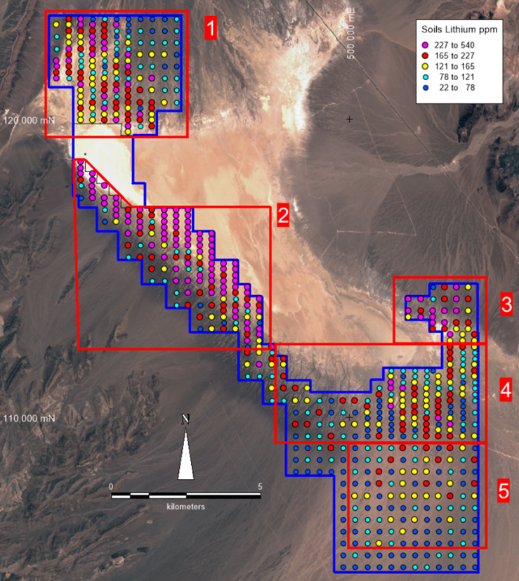
Based on the sampling results, the company has identified five targets. Out of these, three are sediment target zones located in the northern, eastern, and western areas, whereas two are twin targets containing brine and sediment in the upper south and lower south areas.

Source: Company’s update
- Target zone 1 (sediment zone)
The target is in the northern area with a combination of clays and an alluvial fan on the surface. The historical Magnetotelluric (MT) data suggests the potential for deeper sediment in embayment.
It comprises more than 5.4km2 of area with >165ppm lithium content. The peak lithium concentration was 540ppm, with 39 and 13 samples having values greater than 200ppm and 264 ppm, respectively.
- Target zone 2 (sediment zone)
It lies in the western area along with the flanks of the basin. It comprises lake sediments that are exposed in the west and late alluvial fan material in the east.
The area of more than 10km2 has >165ppm lithium content. The peak lithium concentration encountered was 448ppm, with 99 and 61 samples having values greater than 200ppm and 264 ppm, respectively.
- Target zone 3 (sediment zone)
This target lies in the southeastern flank along the trend from the Bonnie Claire deposit. The area comprises an alluvial fan, lake clays and evaporite deposits.
Over 2km2 of the area with >165ppm lithium. The peak lithium concentration encountered was 421ppm, with 17 and 9 samples having values greater than 200ppm and 264 ppm, respectively.
- Target zone 4 (sediment and brine zone)
This zone lies in the southern extension of Bonnie Claire. Historical MT data suggests the presence of deep sediments and brine targets.
Contains over 7km2 area of >165ppm lithium with a peak value of 364 ppm lithium. And, 15 and 5 samples have values greater than 200ppm and 264 ppm, respectively.
- Target zone 5 (sediment and brine zone)
It is in the southern margin extension of the long axis of the basin. Based on the historical gravity and MT data, the possibility of the basin being deeper than originally thought is very high and may have substantial host sediments and brine at depth.
It covers around 4km2 area of >165ppm lithium concentration with a peak value of 214 ppm lithium. It also accounts for two samples having values greater than 200ppm of lithium concentration.
Soil sampling program insights
The Scotty Lithium project, located 189 km northwest of Las Vegas, hosts quartz-rich volcanic rocks containing anomalous amounts of lithium within and adjacent to the drainage basin. A gravity low trends south where historical MT data suggests deep sedimentary beds. These beds have the potential to host lithium-rich evaporitic salts.
For the company's other developments, click here.
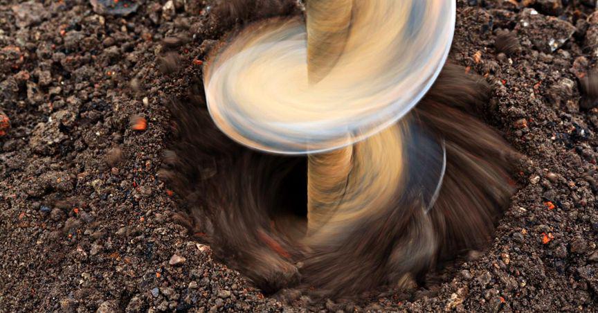
The auger soil sampling program comprised 400m spaced traverses with samples taken at 400m and 200m intervals along traverses. Sampling was done at closer spacings for areas with higher potential for lithium-rich evaporites and clays.
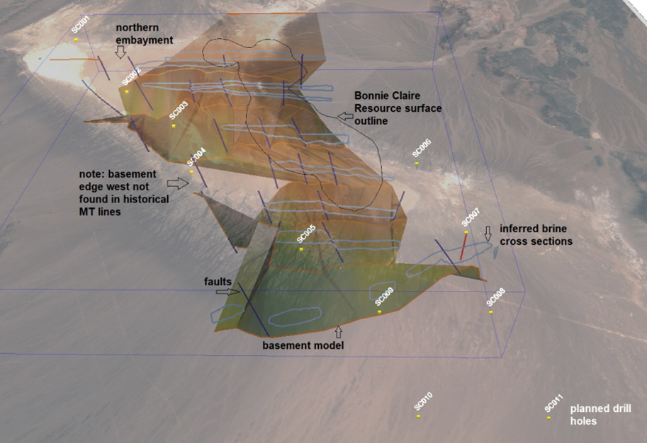
Sample assays were analysed using a self-organising map (SOM - Matlab) to produce a rapid classification of groups within a dataset. The company constructed a 3D geological model based on the information on publicly available databases for understanding the basin and targeting more MT geophysics surveys and drilling.

Source: Company’s update
What’s next?
Monger Gold plans to commission MT surveys within each zone to define the basin extent and optimise subsequent drilling programs.
MMG shares were trading at AU$0.490 midday on 21 September 2022.


