
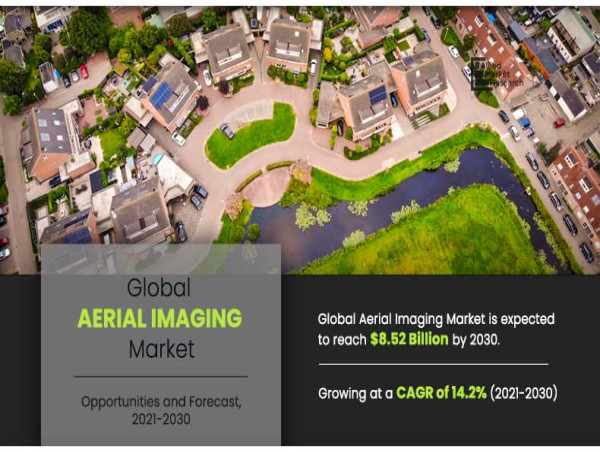

Aerial imaging market to reach $8.52 billion by 2030
PORTLAND, OREGON, UNITED STATES, August 2, 2023/EINPresswire.com/ -- Allied Market Research published a report, titled, "Aerial Imaging Market by Application (Geospatial Mapping, Disaster Management, Energy and Resource Management, Surveillance and Monitoring, Urban Planning and Others), End User (Government, Military and Defense, Energy, Agriculture and Forestry, Civil Engineering, Media and Entertainment, and Commercial), and Platform (Fixed Wing Aircraft, Helicopter, UAV and Drone and Others): Global Opportunity Analysis and Industry Forecast, 2021–2030". According to the report, the global aerial imaging industry generated $2.26 billion in 2020, and is anticipated to generate $8.52 billion by 2030, witnessing a CAGR of 14.2% from 2021 to 2030.
𝐑𝐞𝐪𝐮𝐞𝐬𝐭 𝐒𝐚𝐦𝐩𝐥𝐞 𝐏𝐚𝐠𝐞𝐬- https://www.alliedmarketresearch.com/request-sample/294
Prime determinants of growth
Rise in demand for aerial imaging in varied commercial applications, surge in use of aerial imaging for disaster risk reduction & prevention, and use of aerial imaging technology in setting up 5G infrastructure drive the growth of the global aerial imaging market. However, inaccuracy in image data collection and rise in concerns over cyber-security and data security regarding drones hinder the market growth. On the other hand, surge in demand for aerial imaging for urban planning and rise in incorporation of augmented reality (AR) with drones present new opportunities in the coming years.
Covid-19 Scenario
The outbreak of the COVID-19 pandemic has had a negative impact on the growth of the global aerial imaging market, owing to two major challenges i.e. revenue crunch and rising maintenance costs.
Furthermore, the reduced GDP of major economies, such as the U.S., the UK, China, France, India, Germany, and others, in 2020, resulted in a decline in investment in emerging technologies, including aerial imaging.
The reduction in aerospace investment had a negative impact on unmanned aircraft development and deployment plans, particularly unmanned aerial vehicles (UAVs), thereby limiting the availability for UAV-based aerial imaging services globally.
𝐑𝐞𝐪𝐮𝐞𝐬𝐭 𝐟𝐨𝐫 𝐂𝐮𝐬𝐭𝐨𝐦𝐢𝐳𝐚𝐭𝐢𝐨𝐧 𝐚𝐭- https://www.alliedmarketresearch.com/request-for-customization/294
The geospatial mapping segment to maintain its leadership status throughout the forecast period
Based on application, the geospatial mapping segment held the highest market share in 2020, accounting for one-fourth of the global aerial imaging market, and is estimated to maintain its leadership status throughout the forecast period. This is because geographical mapping through satellites has a wide range of applications in various sectors such as environmental condition analysis, archaeology, mining study and formation of maps and charts etc. Moreover, the urban planning segment is projected to manifest the highest CAGR of 17.2% from 2021 to 2030, owing to growing activities related with urban planning such as land inspection, identification of population risk and tracking of construction activities and others.
The Government segment to maintain its lead position during the forecast period
Based on end user, the Government segment accounted for the largest share in 2020, contributing to one-fifth of the global aerial imaging market, and is projected to maintain its lead position during the forecast period. This is due to application such as land mapping, environmental protection, disaster management, GIS updates, urban development, homeland security, and public safety. However, the civil engineering segment is expected to portray the largest CAGR of 13.4% from 2021 to 2030. This is because it allows companies do real-time monitoring of construction projects.
𝐌𝐚𝐤𝐞 𝐚𝐧 𝐈𝐧𝐪𝐮𝐢𝐫𝐲 𝐁𝐞𝐟𝐨𝐫𝐞 𝐁𝐮𝐲𝐢𝐧𝐠- https://www.alliedmarketresearch.com/purchase-enquiry/294
North America to maintain its dominance by 2030
Based on region, North America held the highest market share in terms of revenue 2020, accounting for nearly two-fifths of the global aerial imaging market, owing to high adoption of aerial imagery among government and military agencies in the region. Moreover, the Asia-Pacific region is expected to witness the fastest CAGR of 16.0% during the forecast period, increase adoption of aerial imaging in various end use sectors in the region.
Leading Market Players
Aerial Imaging Productions, LLC
Blom Norway AS
Cooper Aerial Surveys Co.
Digital Aerial Solutions (DAS), LLC
EagleView Technologies, Inc.
Fugro N.V.
Global UAV Technologies Ltd
Kucera International
Landiscor
Nearmap Ltd.
𝐒𝐢𝐦𝐢𝐥𝐚𝐫 𝐑𝐞𝐩𝐨𝐫𝐭𝐬 𝐖𝐞 𝐇𝐚𝐯𝐞-
Advanced Aerial Mobility Market- https://www.alliedmarketresearch.com/advanced-aerial-mobility-market-A12516
Unmanned Aerial Vehicle (UAV) Market- https://www.alliedmarketresearch.com/unmanned-aerial-vehicle-market-A09059
Commercial Satellite Imaging Market- https://www.alliedmarketresearch.com/commercial-satellite-imaging-market
David Correa
Allied Analytics LLP
1 800-792-5285
email us here
