
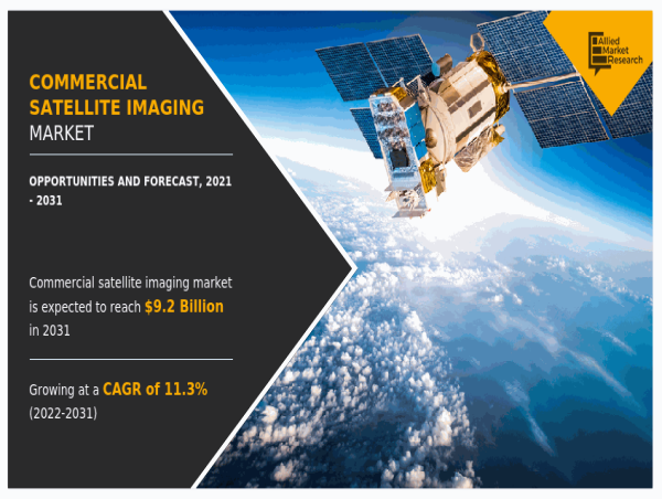

WILMINGTON, NEW CASTLE, DELAWARE, UNITED STATES, May 27, 2024 /EINPresswire.com/ -- The 𝐂𝐨𝐦𝐦𝐞𝐫𝐜𝐢𝐚𝐥 𝐒𝐚𝐭𝐞𝐥𝐥𝐢𝐭𝐞 𝐈𝐦𝐚𝐠𝐢𝐧𝐠 𝐌𝐚𝐫𝐤𝐞𝐭 report offers a detailed analysis of changing market trends, top segments, key investment pockets, value chain, regional landscape, and competitive scenario. The global commercial satellite imaging market size was valued at $3.3 billion in 2022, and is projected to reach $9.6 billion by 2032, growing at a CAGR of 11.5% from 2023 to 2032.
𝐑𝐞𝐪𝐮𝐞𝐬𝐭 𝐒𝐚𝐦𝐩𝐥𝐞 𝐏𝐚𝐠𝐞𝐬 𝐍𝐨𝐰: https://www.alliedmarketresearch.com/request-sample/1751
The commercial satellite imaging market is segmented into application, end user, and region. By application, the market is categorized into geospatial data acquisition & mapping, urban planning & development, disaster management, energy & natural resource management, surveillance & security, defense & intelligence, and others. By end user, it is segregated into government, military & defense, forestry & agriculture, energy, civil engineering & archaeology, transportation & logistics, and others. By region, the market is analyzed across North America, Europe, Asia-Pacific, Latin America, and Middle East and Africa.
𝐓𝐡𝐞 𝐤𝐞𝐲 𝐩𝐥𝐚𝐲𝐞𝐫𝐬 𝐩𝐫𝐨𝐟𝐢𝐥𝐞𝐝 𝐢𝐧 𝐭𝐡𝐢𝐬 𝐫𝐞𝐩𝐨𝐫𝐭 𝐢𝐧𝐜𝐥𝐮𝐝𝐞
𝐈𝐌𝐀𝐆𝐄𝐒𝐀𝐓 𝐈𝐍𝐓𝐄𝐑𝐍𝐀𝐓𝐈𝐎𝐍𝐀𝐋 𝐍.𝐕, 𝐏𝐋𝐀𝐍𝐄𝐓 𝐋𝐀𝐁𝐒 𝐈𝐍𝐂, 𝐒𝐏𝐀𝐂𝐄𝐊𝐍𝐎𝐖, 𝐓𝐄𝐋𝐄𝐒𝐏𝐀𝐙𝐈𝐎 𝐅𝐑𝐀𝐍𝐂𝐄, 𝐌𝐀𝐗𝐀𝐑 𝐓𝐄𝐂𝐇𝐍𝐎𝐋𝐎𝐆𝐈𝐄𝐒 𝐈𝐍𝐂, 𝐆𝐀𝐋𝐈𝐋𝐄𝐎 𝐆𝐑𝐎𝐔𝐏, 𝐈𝐍𝐂, 𝐔𝐑𝐓𝐇𝐄𝐂𝐀𝐒𝐓 𝐂𝐎𝐑𝐏, 𝐁𝐋𝐀𝐂𝐊𝐒𝐊𝐘 𝐆𝐋𝐎𝐁𝐀𝐋 𝐋𝐋𝐂, 𝐇𝐀𝐑𝐑𝐈𝐒 𝐂𝐎𝐑𝐏𝐎𝐑𝐀𝐓𝐈𝐎𝐍, 𝐄𝐔𝐑𝐎𝐏𝐄𝐀𝐍 𝐒𝐏𝐀𝐂𝐄 𝐈𝐌𝐀𝐆𝐈𝐍𝐆
Similarly, energy companies are also adopting commercial satellite imagery services for enhancement in productivity, which supports the market growth. For instance, in May 2022, ProStar Holdings Inc., a major company in Precision Mapping Solutions, was announced that Scout Energy Partners, signed a service-level agreement (SLA) for ProStar’s cloud and mobile solution to improve the management and safety of pipeline operations.
Based on application, the geospatial data acquisition and mapping segment accounted for the highest share in 2021, contributing to more than one-fourth of the total market share, and is estimated to continue its lead position during the forecast period. However, the defense & intelligence segment is projected to manifest the highest CAGR of 13.3% from 2022 to 2031.
𝐁𝐮𝐲 𝐍𝐨𝐰 𝐭𝐡𝐞 𝐄𝐱𝐜𝐥𝐮𝐬𝐢𝐯𝐞 𝐑𝐞𝐩𝐨𝐫𝐭: https://www.alliedmarketresearch.com/checkout-final/19df2e8fa9bad1c50611207e8bf1d2d7
The commercial satellite imaging market is segmented into application, end user, and region. By application, the market is categorized into geospatial data acquisition & mapping, urban planning & development, disaster management, energy & natural resource management, surveillance & security, defense & intelligence, and others. By end user, it is segregated into government, military & defense, forestry & agriculture, energy, civil engineering & archaeology, transportation & logistics, and others. By region, the market is analyzed across North America, Europe, Asia-Pacific, Latin America, and Middle East and Africa.
Furthermore, the commercial satellite imaging market size is projected to witness considerable growth, especially in North America, owing to the presence of sophisticated infrastructure to undertake space programs and the earliest & highest adoption of commercial satellite imaging across various industries. Commercial and government space organizations are adopting various innovative techniques to provide customers with advanced and innovative feature offerings.
𝐑𝐞𝐠𝐢𝐨𝐧𝐚𝐥 𝐀𝐧𝐚𝐥𝐲𝐬𝐢𝐬:
Based on region, North America contributed to the highest share in 2021, holding nearly two-fifths of the total market share, and is expected to continue its dominant share by 2031. However, Asia-Pacific is projected to portray the fastest CAGR of 12.9% during the forecast period.
𝐆𝐞𝐭 𝐂𝐮𝐬𝐭𝐨𝐦𝐢𝐳𝐞𝐝 𝐑𝐞𝐩𝐨𝐫𝐭𝐬 𝐰𝐢𝐭𝐡 𝐲𝐨𝐮’𝐫𝐞 𝐑𝐞𝐪𝐮𝐢𝐫𝐞𝐦𝐞𝐧𝐭𝐬: https://www.alliedmarketresearch.com/request-for-customization/1751
Based on end user, the government segment held the largest share in 2021, accounting for more than one-fifth of the global commercial satellite imaging market. However, the civil engineering and archaeology segment is expected to register the largest CAGR of 13.2% during the forecast period.
𝐊𝐄𝐘 𝐅𝐈𝐍𝐃𝐈𝐍𝐆𝐒 𝐎𝐅 𝐓𝐇𝐄 𝐒𝐓𝐔𝐃𝐘
By application, the geospatial data acquisition and mapping segment is anticipated to dominate the market in the coming future.
By end user, the government segment is anticipated to lead the market.
By region, Asia-Pacific is anticipated to register the highest CAGR during the forecast period.
𝐂𝐡𝐞𝐜𝐤 𝐨𝐮𝐭 𝐦𝐨𝐫𝐞 𝐫𝐞𝐥𝐚𝐭𝐞𝐝 𝐬𝐭𝐮𝐝𝐢𝐞𝐬 𝐩𝐮𝐛𝐥𝐢𝐬𝐡𝐞𝐝 𝐛𝐲 𝐀𝐌𝐑 𝐑𝐞𝐬𝐞𝐚𝐫𝐜𝐡:
Small Satellite Market - https://www.globenewswire.com/en/news-release/2021/09/20/2299922/0/en/Small-Satellite-Market-to-Hit-13-71-Billion-by-2030-Allied-Market-Research.html
Aerial Imaging Market - https://www.globenewswire.com/en/news-release/2021/12/09/2348758/0/en/Aerial-Imaging-Market-to-Garner-8-51-Billion-by-2030-Allied-Market-Research.html
Aircraft Electrification Market - https://www.globenewswire.com/en/news-release/2023/05/05/2662272/0/en/Aircraft-Electrification-Market-Predicted-to-Reach-21-8-Billion-Globally-by-2032-at-13-5-CAGR-Allied-Market-Research.html
Special Mission Aircraft Market - https://www.globenewswire.com/en/news-release/2023/11/08/2776101/0/en/Special-Mission-Aircraft-Market-to-Generate-26-5-Billion-by-2031-at-5-9-Staes-Allied-Market-Research.html
David Correa
Allied Market Research
+ 18007925285
email us here
Visit us on social media:
Facebook
Twitter
LinkedIn
Other
![]()
