

Understanding the Interface Coordination Issue:
The interface coordination issue between small drone operators and the command center stems from the need to establish seamless communication and real-time information sharing. In traditional setups, operators rely on verbal communication and manual reporting, which can lead to delays, misinterpretations, and limited situational awareness. This lack of coordination hampers the effectiveness and efficiency of drone operations, potentially compromising mission success.
The AGIS C5ISR COP offers a comprehensive solution to the interface coordination issue by providing a centralized platform for real-time data sharing, visualization, and collaboration and is unique in its ability to seamlessly translate and forward in the different message formats and protocols used by the U.S. and NATO forces. Built and designed to synchronize data flows, the AGIS COP enables small drone operators and the command center to have a shared understanding of the operational environment, enhancing situational awareness and decision-making capabilities.
Benefits of Integrated COP in Drone Operations:
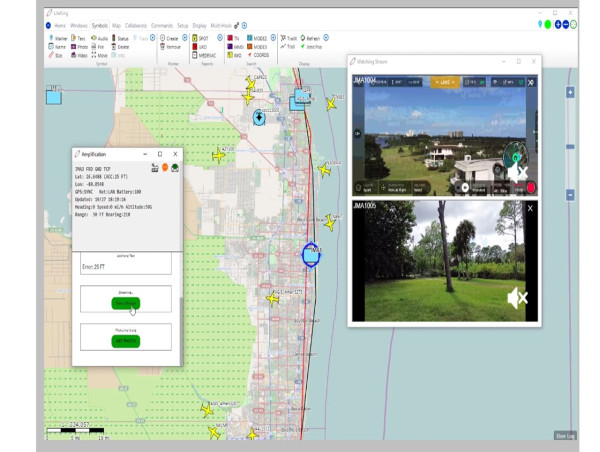
1. Real-time Data Sharing: AGIS C5ISR COP allows small drone operators to transmit live video feeds, sensor data, and other relevant information to the command center instantaneously. This real-time data sharing enables commanders to make informed decisions based on up-to-date situational awareness.
2. Enhanced Situational Awareness: By integrating data from multiple sources, including drones, ground sensors, maritime sensors, and other intelligence systems, the AGIS C5ISR COP provides a holistic view of the operational environment. This enhanced situational awareness enables operators and commanders to identify threats, assess risks, and respond effectively.
3. Improved Communication and Collaboration: The AGIS C5ISR COP facilitates seamless communication and collaboration between small drone operators and the command center. Operators can receive mission updates, tasking orders, and feedback directly, eliminating the need for time-consuming verbal exchanges. Coupled with its capability of integration with Government Furnished Equipment, e.g., other C2 and C5ISR systems, the AGIS COP provides a streamlined communication process that improves operational efficiency and reduces the potential for miscommunication across echelons and military services.
4. Data Analysis and Historical Insights: The AGIS C5ISR COP includes analytical capabilities that allow operators and commanders to analyze past mission data, identify patterns, and gain valuable insights. These insights can inform soldier training, mission planning, future operations, optimize resource allocation, and enhance overall performance.
Typical AGIS C5ISR COP Use Case:
1. When equipped with this software, the Command Center receives the location of a possible Hostile vehicle, vessel, or patrol from a satellite or UAV feed, or soldier input.
2. The Command Center can automatically transmit the location of a still undetermined vehicle, vessel, or patrol to a UAV operator with a weaponized UAV along with an AGIS C5ISR COP on the same display used to control the UAV.
3. When there is confirming information, the Command Center can digitally change the identity from “undetermined” to Hostile.
4. And this change of identity to Hostile is instantly seen by the UAV operator with a weaponized UAV on the AGIS C5ISR Android / UAV Control display.
5. The Command Center can now send a <Must Respond Message> requiring a WILCO, HAVCO or CANTCO response from the UAV operator, confirming the location coordinates and instructing the operator to engage the Hostile.
6. Following orders from the Command Center, the UAV operator can now launch a weaponized UAV. While in flight, the location of the UAV and video is immediately transmitted to the Command Center and video is viewed on their AGIS C5ISR COP display.
7. The UAV operator takes and shares a video of the target being sighted, and the Command Center has immediate visual confirmation and all on the network can see the real-time process of a target being tactically engaged.
8. The Command Center can then update the digital C5ISR map with the correct symbol associated with the action that took place and send a confirmation message to all units.
Conversely, if the Command Center receives other supporting intelligence information and makes the determination that the undetermined vehicle or patrol is in fact a ‘Friendly’, the Command Center operator can immediately send a <Must Respond Message> to the UAV operator to cease the weaponized engagement. All units on the AGIS COP will instantaneously see this new identification/designation and read the instruction not to engage.
The interface coordination issue between small drone operators and the command center in military operations can be effectively addressed through the implementation of the AGIS C5ISR COP. Technology tools such as this enable real-time data sharing, enhance situational awareness, improve communication and collaboration, and provide valuable analytical capabilities. By leveraging the power and integration of digital COP tools, military organizations can overcome the challenges associated with coordinating small drone operations, ultimately leading to more successful and efficient missions.
Malcolm K. Beyer, Jr.
Advanced Ground Information Systems (AGIS), Inc.
+1 561-744-3213
[email protected]
