


Highlights
• Rare earth exploration activity progresses with airborne survey completion at Music Valley project.
• Dateline Resources Ltd (ASX:DTR) advances geological understanding through geophysical data and field programs.
• Integrated mapping and sampling programs continue to support exploration across expanded project areas.
Dateline Resources advances rare earth exploration at Music Valley through airborne surveys and field programs, highlighting ongoing geological work within the All Ordinaries mining sector.
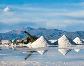
The rare earth and mining exploration sector plays a critical role in supplying essential materials used across advanced technologies, renewable energy systems, and industrial manufacturing. Rare earth elements are widely used in electric vehicles, wind turbines, electronics, and defence applications, making exploration in this segment an important part of global resource development. Companies operating in this space contribute to the broader Australian equity landscape represented by the All Ordinaries.
Dateline Resources Ltd (ASX:DTR) operates within the mining exploration sector with a focus on rare earth elements and mineral development projects across international locations. Exploration companies engaged in rare earth projects often conduct geological surveys and technical programs aimed at identifying mineralisation zones associated with critical materials.
The mining exploration sector relies on advanced technologies such as airborne geophysical surveys, geological mapping, and sampling programs to improve understanding of mineral systems. These methods provide detailed information about subsurface geology and assist in identifying zones of mineral concentration.
Project updates related to exploration programs often highlight the completion of technical surveys and the commencement of field activities designed to expand geological knowledge across project areas. These activities represent ongoing efforts to refine exploration targets and understand mineral distribution.
Within the wider Australian equity ecosystem represented by the asx all ords, mining companies operate alongside sectors such as finance, healthcare, industrials, and technology, contributing to the overall diversity of listed companies.
Airborne Geophysical Surveys and Data Integration
Airborne geophysical surveys represent a key tool used in mineral exploration to map geological structures beneath the surface. These surveys involve specialised equipment mounted on aircraft that collect data related to magnetic properties and radiation levels within rock formations.
High-resolution airborne surveys provide detailed datasets that help geologists interpret geological structures and identify anomalies associated with mineralisation. These datasets allow for the mapping of rock types, fault systems, and mineral-bearing formations across large areas.
Once survey data is collected, it undergoes processing and interpretation by geophysical specialists. Techniques such as inversion modelling are used to convert raw data into meaningful geological representations.
The integration of airborne survey data with existing geological information enhances the understanding of mineral systems and supports the identification of exploration targets. These datasets are often combined with field mapping and sampling programs to create comprehensive geological models that guide further exploration activities.
Across the Australian market, companies from various sectors are sometimes discussed in the context of ASX dividend stocks, reflecting the broad range of industries represented within listed markets.
Field Mapping and Geological Sampling Programs
Field mapping and sampling programs play a vital role in validating geological interpretations derived from geophysical surveys. These activities involve on-site investigations conducted by geologists who examine rock formations and collect samples for laboratory testing.
Geological mapping documents the distribution of rock types, structural features, and mineral occurrences within a project area. This information helps refine geological models and identify areas of interest for further investigation.
Sampling programs involve collecting rock samples from surface outcrops and contact zones where different rock types intersect. These samples are analysed to determine mineral composition and the presence of rare earth elements. Laboratory testing of rock samples provides quantitative data regarding mineral content and supports the identification of mineralised zones within the project area.
Field programs often focus on specific geological formations believed to host mineralisation, such as metamorphic rocks and contact zones associated with mineral-bearing systems. These programs contribute to a deeper understanding of the geological framework of exploration projects.
Rare Earth Elements and Industrial Applications
Rare earth elements are a group of metals used in a wide range of high-technology applications. These materials are essential components in the manufacturing of permanent magnets, batteries, and electronic devices.
The transition toward renewable energy systems has increased demand for rare earth elements, as they are used in wind turbines and electric vehicle motors. Rare earth metals also play an important role in defence technologies and advanced manufacturing processes.
Mining companies engaged in rare earth exploration aim to identify deposits capable of supporting future extraction and processing activities. The supply of rare earth elements remains an important factor in global industrial systems, influencing the development of technologies across multiple sectors. Exploration programs therefore contribute to identifying resources that may support long-term supply chains.
Exploration Strategy and Project Development
Exploration strategies often involve a phased approach that begins with data collection and progresses toward target identification and drilling programs. Each stage of exploration builds upon previous findings to refine understanding of the geological system.
Airborne surveys and geophysical studies provide initial insights into subsurface structures. These insights are then validated through field mapping and sampling programs conducted on the ground.
Once sufficient data is collected, exploration teams identify targets for drilling programs. Drilling provides direct evidence of mineralisation and helps define the extent of mineral deposits.
Project development involves continuous evaluation of geological data to determine the viability of mineral resources within a project area. Exploration companies may expand project areas to include additional tenements where geological conditions are favourable for mineralisation. These strategies contribute to building exploration pipelines and advancing projects through different stages of development within the mining sector.
