
 AUS
AUS
 NZ
NZ
 UK
UK
 CA
CA
 USA
USA
 IND
IND






Highlights
- Viking Mines has engaged Rock Bottom Geosciences for dual-method gravity and ground magnetic surveys at the Linka Project in Nevada.
- The program will focus on defining subsurface structure and high-priority drill targets.
- Survey results will be integrated into the company’s 3D geological model to support drill targeting and permitting activities.
- Exploration work continues alongside metallurgical testing and assessment of additional Nevada tungsten projects.
Viking Mines Ltd (ASX:VKA) has engaged specialist geophysical contractors Nevada-based Rock Bottom Geosciences LLC to undertake a high-resolution geophysical survey program at its Linka Project in Nevada, USA. Scheduled to commence in mid-February, the program will integrate gravity and ground magnetic surveys. This work forms part of Viking’s broader exploration strategy to delineate subsurface structures, map bedrock geology, and identify priority drill targets along the project’s established mineralised trend.
Survey Design: Mapping Subsurface Structures
The high-density gravity survey will cover an area of approximately 1km², using a station grid with spacing of 20 metres by 40 metres. This configuration is intended to map density contrasts between tungsten-bearing skarn mineralisation and surrounding host rocks. In parallel, a ground magnetic survey will be completed across 2.3km² on 20-metre line spacing, targeting the definition of primary structural controls and intrusive boundaries.
These methods are expected to assist in outlining the contact between intrusive monzonite and the adjacent sedimentary sequence. This contract horizon represents the principal geological control on high-grade tungsten mineralisation at Linka. Modelling this boundary in three dimensions enables the company to track the system along strike and identify potential high-grade zones that are not evident at surface.
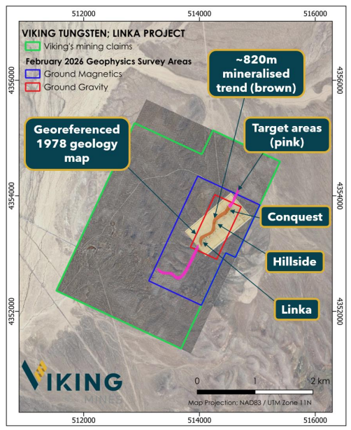
Map of the Linka Project showing Viking’s claims. Image source: Company update
Targeting Hidden Mineralisation Beneath Volcanic Cover
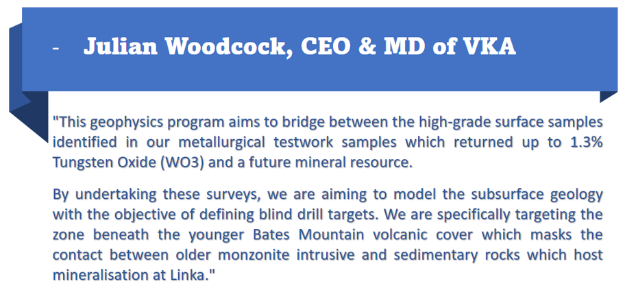
Exploration at Linka is partly constrained by the presence of the post-mineralisation Bates Mountain volcanic tuff, which masks older mineralised units along strike to the northeast and southwest. The gravity and magnetic surveys are designed to penetrate this volcanic cover and enhance interpretation of the underlying bedrock geology based on physical density and magnetic properties.
Improving visibility beneath this cover is expected to help in identifying potential extensions to the known mineralised corridor that have not been accessible through surface exploration.
Integrating Data for Drilling and Permitting
Results from the geophysical surveys will be incorporated into the company’s 3D geological model. This integration will be used to test the existing 820-metre strike extension and supporting the prioritisation of drill targets.
The geophysical data will also contribute to the preparation of a Notice of Intent submission to Federal Agencies to secure ground-disturbing activities approval. Detailed subsurface models are expected to form part of the permitting documentation.
Ongoing Exploration and Next Steps
Alongside the geophysics program, the company continues to digitise historical exploration data and advance metallurgical testwork on a high-grade Linka Pit sample. Initial metallurgical results are expected in February 2026. Technical assessment of five additional Nevada tungsten projects is also ongoing to support future regional exploration planning.
VKA shares were trading at AUD 0.012 per share at the time of writing on 29 January 2026.
