


Highlights
- Mineral resource estimation work is progressing across multiple unmined Sherridon deposits near historic operations
- Recent drilling and validation efforts are being integrated to strengthen geological understanding
- Infrastructure access and regional geology support continued technical evaluation
T2 Metals continues geological evaluation at the Sherridon project, integrating drilling data, historical validation, and infrastructure context to refine understanding of polymetallic mineralization.
The mineral exploration sector includes companies focused on evaluating historic districts and advancing geological data to better define subsurface mineralization. Within this context, T2 Metals (TSX:TWO) is progressing mineral resource estimation activities at the Sherridon project in Manitoba, a volcanogenic massive sulphide district known for its historical mining footprint. Current work centers on validating legacy datasets and integrating modern drilling to refine geological interpretation across several unmined deposits located near previously developed areas.
Project Setting And Geological Context
The Sherridon project is positioned within a well-known greenstone belt characterized by volcanogenic massive sulphide mineralization. This geological environment is associated with copper, zinc, gold, and silver occurrences formed through ancient hydrothermal processes. Historical mining activity established the district as a notable source of polymetallic mineralization, leaving behind extensive geological records and infrastructure corridors that continue to inform present-day evaluation.
T2 Metals (TSX:TWO) is examining deposits that lie along the same interpreted mineralized horizon as former producing areas. Geological continuity across the district supports ongoing technical work aimed at mapping subsurface structures, mineral zones, and host rock relationships. Field programs have emphasized the compilation and verification of archived drill logs, assay documentation, and metallurgical records to ensure consistency with modern reporting standards.
Integration Of Modern Drilling Data
Recent drilling campaigns completed by T2 Metals (TSX:TWO) form a key component of the current resource estimation process. These programs targeted extensions of known mineral zones and provided updated geological sampling under contemporary quality control frameworks. Drill core observations have contributed to improved characterization of sulphide mineral textures, alteration patterns, and structural features.
The integration of historic and modern datasets allows geoscientists to construct refined block models that better represent mineral distribution. Validation procedures include cross-checking laboratory results, reviewing drilling methodologies, and confirming spatial accuracy. This structured workflow supports consistent geological interpretation while maintaining transparency in technical documentation.
Infrastructure And Regional Access
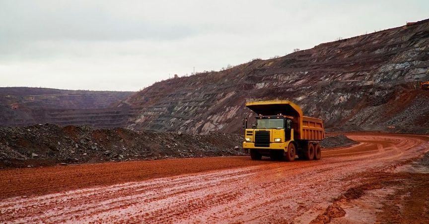
The Sherridon area benefits from established transportation and logistical access associated with earlier mining operations. Road connections and rail corridors traverse the district, enabling efficient movement of equipment and personnel during field activities. Nearby communities provide operational support and contribute to continuity in regional land use.
T2 Metals (TSX:TWO) continues to evaluate how existing infrastructure aligns with exploration objectives. Proximity to other mineral developments within the same geological belt reinforces the district’s relevance to ongoing technical study. Geological similarities across the belt offer comparative reference points that inform interpretation of mineralized horizons at Sherridon.
Resource Estimation Methodology
Mineral resource estimation involves constructing geological models that synthesize drilling data, sampling results, and structural mapping. Independent technical specialists oversee verification procedures to confirm dataset integrity prior to modeling. The process includes reviewing lithological boundaries, mineral zoning, and continuity patterns observed within the drill database.
At Sherridon, emphasis is placed on understanding copper-rich mineralization within the broader polymetallic framework. Geological modeling incorporates density measurements, mineral textures, and host rock relationships to establish consistent classification parameters. Data validation workflows are designed to support accurate representation of subsurface conditions without extrapolating beyond verified information.
Historical Mining Legacy
The Sherridon district contains extensive records from earlier extraction phases that documented mineral occurrences across several deposits. Archived geological mapping and production records provide valuable context for interpreting present-day drill results. While historical estimates exist, current technical work focuses on validating datasets using contemporary reporting practices.
T2 Metals (TSX:TWO) is not treating historical figures as current mineral resources. Instead, archived material serves as a geological reference that guides modern exploration targeting. The district’s mining legacy contributes to a broader understanding of mineral system evolution, structural controls, and deposit geometry.
Regional Geological Significance
The broader greenstone belt hosting Sherridon is recognized for its mineral endowment and complex volcanic history. Rock sequences within the belt preserve evidence of ancient hydrothermal circulation responsible for sulphide deposition. Comparative geological studies across nearby districts enhance interpretation of mineral continuity and alteration patterns.
T2 Metals (TSX:TWO) continues to examine how regional structural trends influence localized mineralization. Cross-district geological correlations assist in refining exploration models and identifying zones that warrant additional technical evaluation. Field observations emphasize consistency in lithology and structural orientation across the project area.